High Ledges Wildlife Sanctuary, MA
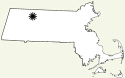
Location: Shelburne, Massachusetts
Access: The entrance to the park is off of Patton Ave in Shelburne, MA. This is reached via Little Mohawk Road, which is a turn off of Route 2 just east of Shelburne Falls and Route 112. Driving Directions
Fees: Audubon members, free; non-members, $3 adults, $2 children and seniors (drop box payment system)
Activities: hiking
Features: 586 acres, overlook offering views of Shelbourne Falls, the Deerfield River valley and the Green Mountains.
Habitats: forest, meadow, fen, swamp, stream, rock ledges.
The sanctuary is an interesting mix of habitats and contains an interesting flora. Twenty orchid species and thirty fern species are known to occur there. The core portion of the property was donated by Ellsworth and Mary Barnard, who enjoyed the natural beauty of the property for many years.
A Field Report from High Ledges
I visited High Ledges in August of 2009. Find the sanctuary was easy despite the windyness of Patton Road, since there were a number of small Sanctuary signs at key places where there road split.
The parking lot was a small area that was not far in from the road. Apparently there was a larger parking area that was further back along this road but it is no longer used. High Ledges is accessed by continuing down the road you came in on, but that is gated right before the parking area.
After passing through a strip of forest and a few side roads that go off to the right (private property and not part of High Ledges), we came to a multi-acre field that had a number of old apple trees within it. To the right was the Waterthrush Trail and our starting path for the day (you can continue down the roadbed to a trail that takes you directly to High Ledges lookout). The trail passed through a few different forest types, some swampy areas, across and through some stream areas and into a small fen. We kept to the outside, eastern trail all the way to Wolf Den, but did not take the North Trail. There is quite a steep section that comes up the mountain and we would have had to traverse had we continued from Wolf Den. Instead we took the Wolf Den Trail loop around to the junction of the trail that led to the Ledges overlook. There was a small bit of steeper climbing here but it was not bad. Soon we were at the over look.
From our perch we could see into the valley below us. It was a nice view and the rock ledge here was a good place to sit and take a lunch break. Just behind us was the remnants of the home that belonged to the Barnards. It apparently had burned down and all that is left is a chimney and some of the walls.
From here it was a relatively easy walk back along the Ledges trail to where we entered the Waterthrush Trail and from there back to our car. I have included a few different maps below including an overlay that shows the course my GPS recorded of our route.
High Ledges Maps and Photos
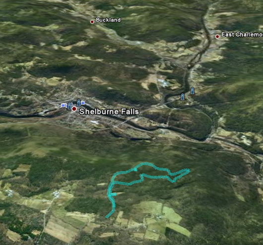
The route outlined on the map shows a GPS recorded track through much of the trail system at High Ledges. The left portion of the track is the area leading away from the parking lot, the loop closer to the foreground is the Waterthrush and Wolf Den Trails, and the trail closer to the horizon is the Ledges trail. The view beyond the trail system provides some perspective on what you can take in while you are at the Ledges lookout.
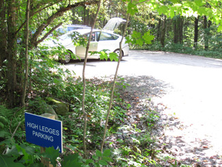
The parking area.
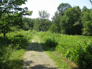
A meadow that is a five to ten minute walk from the parking area. The Waterthrush Trail is off to the right.
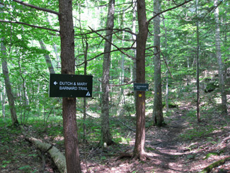
A forest trails crossroads.
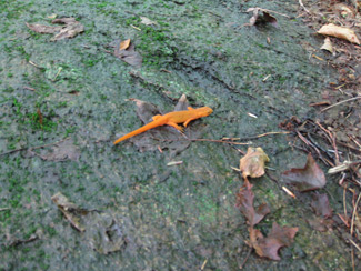
An eft that was walking on a rock along the edge of the trail. This is a juvenile newt that will, if it survives, become an adult that lives in the water.
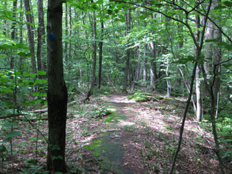
A woodland trail.
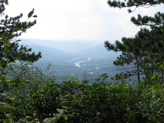
A view of the Deerfield River Valley from the lookout at High Ledges. Just behind where this picture is taken is the remnants of the Barnard house.
More Public Land Journal field reports from Massachusetts public lands:
Horesneck Beach State Reservation
Laughing Brook Wildlife Sanctuary
Other Massachusetts outdoor resources
Find other Massachusetts Public Lands
- Land Unit:
- State: